Locations
This section is currently in Beta
If you encounter unusual behaviour or bugs, please raise them to your Account Manager or open a support ticket.
The Locations page provides a visual overview of the last known location of your connected products. Use it to review fleet distribution by country, filter by various attributes, and move from a fleet-level view, to the details for an individual product.
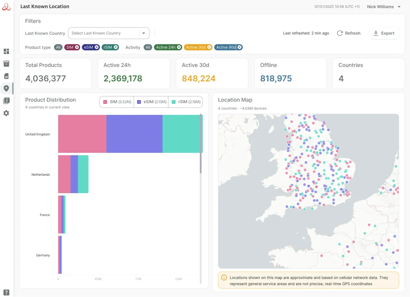
Locations shown on this map are approximate and based on cellular network data from the last known connectivity session. They represent general service areas and not precise, real-time GPS coordinates.
Product Distribution by Country
The Product Distribution chart provides a simplified view of product distribution by country. Here you can quickly see how many of each product type, were last seen in individual countries.
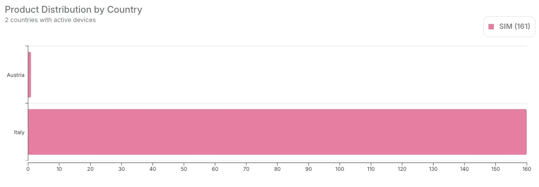
The chart will update dynamically as filters are applied.
Chart Data
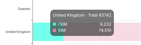
Hovering over an individual chart segment, clearly highlights the number of products for that product type and country.
Legend Selectors
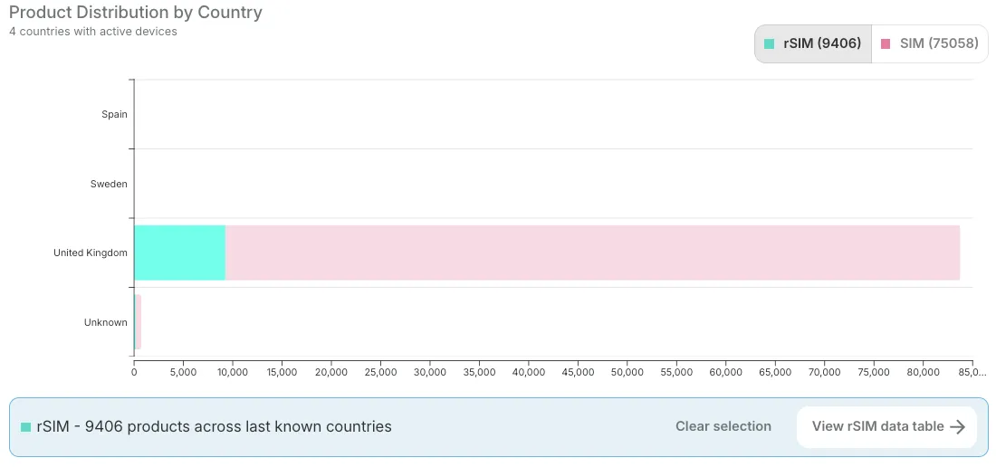
The chart legends show the combined total of each product type. Clicking on one these legends highlights those product types in the chart, and opens a new dialogue box below. From here you can either clear the current selection, or click "View product data table", to link through to the appropriate inventory view of these products.
Location Map
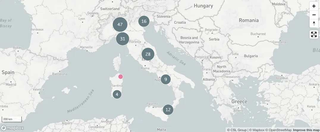
The Location Map provides an intuitive and dynamic, interactive view of product locations.
Navigation
Navigation can be performed using either your mouse-wheel, trackpad, or the on-screen controls, in a familiar way to using any other mapping application.
For mouse-wheel - scrolling whe wheel will zoom in and out. For a trackpad, "pinch-to-zoom" performs the same function.
The "+" and "-" buttons within the map can also control zoom level, whilst the icon with two arrows allows for adjusting the orientation of the map.
The "Expand" button (4 arrows pointing outwards), extends the map view to full screen. Pressing the same icon (now showing 4 arrows pointing inwards), or pressing the "Escape" key on your keyboard, returns the map to a docked view within the dashboard.
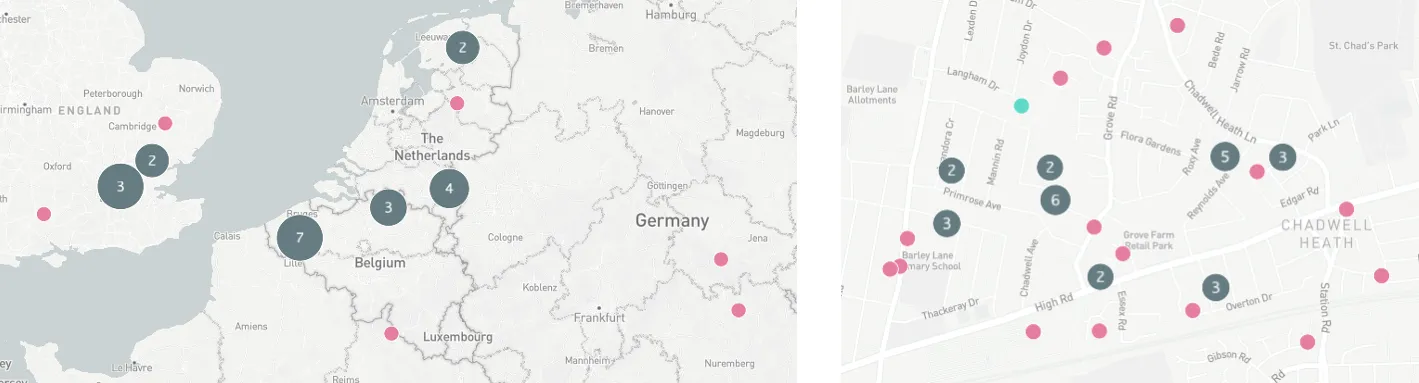
When zooming in and out on the interactive map, location data may take a few seconds to fully refresh, particularly when there are very large data sets.
Clusters and Location Data Points
Nearby devices are grouped into clusters to keep the map clear and responsive. Zooming in further allows you to see more granular clusters, and view the individual product locations within them.
The individual location data points are colour-coded by product type, to help identify at-a-glance whether they're a SIM, rSIM, Router, etc.
Selected Device Detail
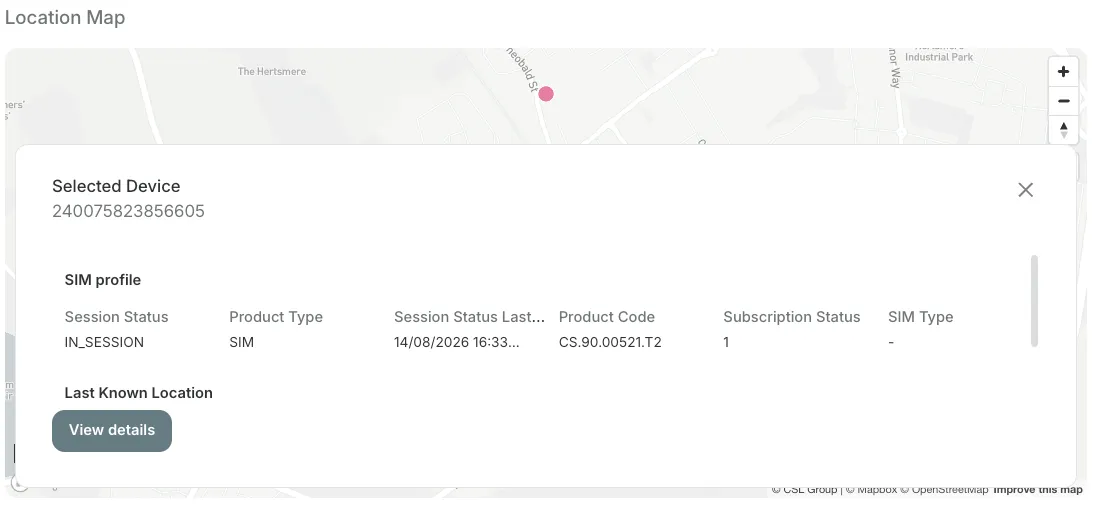
Clicking on an individual product location data point surfaces a card with product detail. Clicking on the "View details" button takes you to the relevant "SIM Details" page, where you can see detailed information about the product and it's location.
Filters
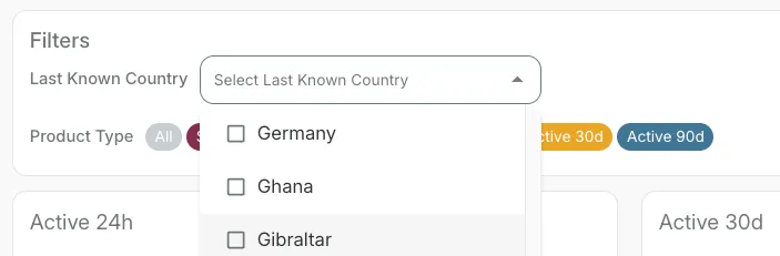
Last Known Country
From the drop-down Country Selector, select as many of the available countries as required, to narrow the data to specific countries. Your selection is then reflected dynamically across the cards, chart, and interactive map.
Product Type
Selecting or removing "Product Type" chips from the Filters section applies filtering dynamically across the cards, chart, and interactive map. Selecting "All" restores the view of all product types.

Activity
Selecting an "Activity" chip from the Filters section applies filtering dynamically across the cards, chart, and interactive map. Selecting "All" restores the view of all product types.
One of these filters may be selected at any one time, to view all products with session activity recency from the last 24 hours, 30 days, or 90+ days.

Refresh Location Data
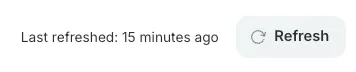
To the right-hand side of the Filters panel, the "Last Refreshed" indicator displays the recency of data shown in the dashboard. Pressing the "Refresh" button, refreshes the page with the current snapshot.
Information Cards
The Information Cards display summaries of products with session activity recency from the last 24 hours, 30 days, or 90+ days; and the total number of countries across which they are distributed.

The information cards will update dynamically as filters are applied.
SIM Details: Location Tab
The Location tab on the SIM Details page shows the last known location, co-ordinates, accuracy in Metres, and the available network and session information for the individual product.
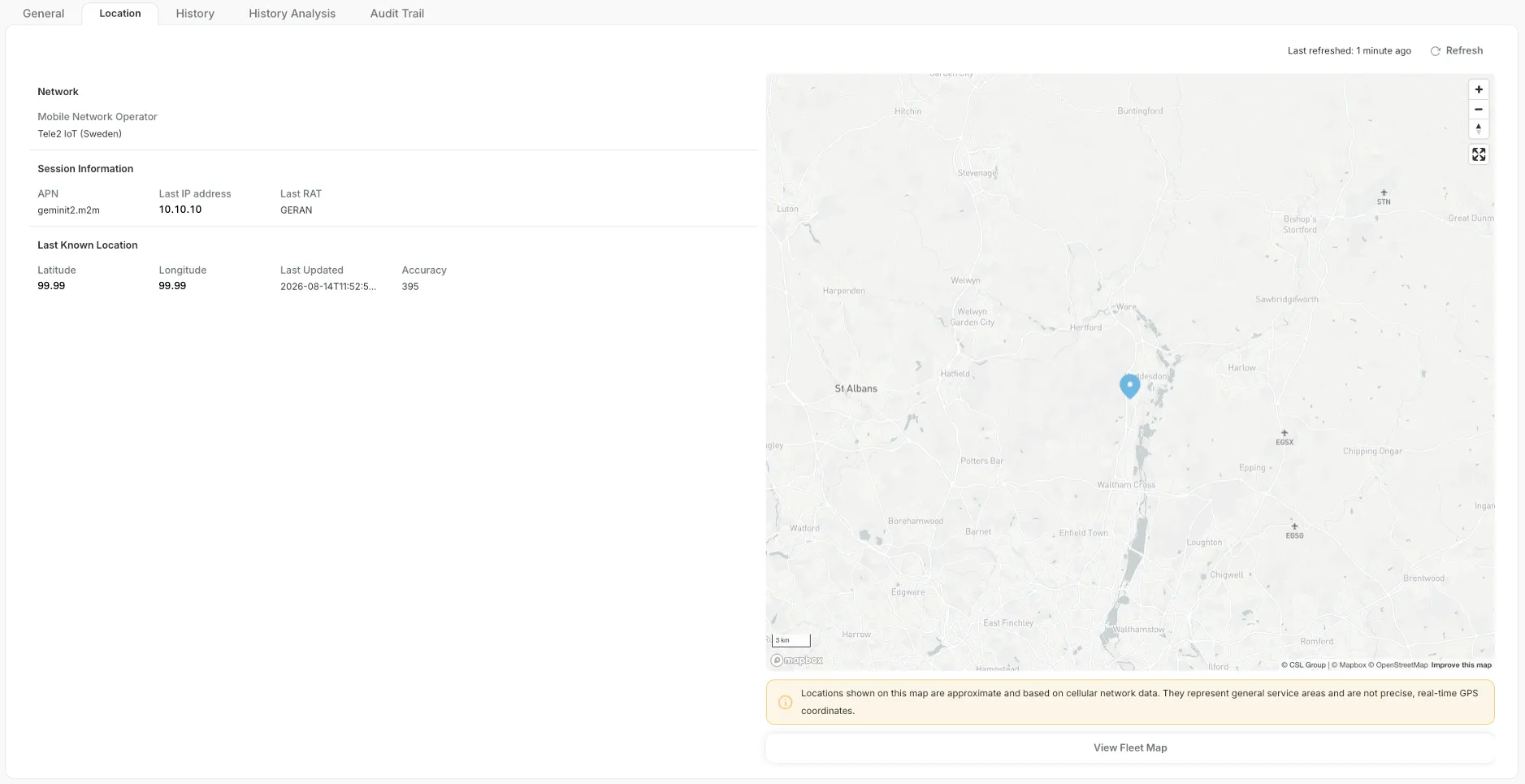
Locations shown on this map are approximate and based on cellular network data from the last known connectivity session. They represent general service areas and not precise, real-time GPS coordinates.
Activity indicator
On the SIM Details Location tab, the Location Pin colour indicates how recently the product was active:
- Green = Active session within the last 24 hours
- Amber = Active session within the last 30 days
- Blue = Active session within the last 90+ days
View Fleet Map
At the bottom right of the page below the map highlighting individual product location, the button "View Location Map", returns you to the main Locations dashboard.
Location Not Available
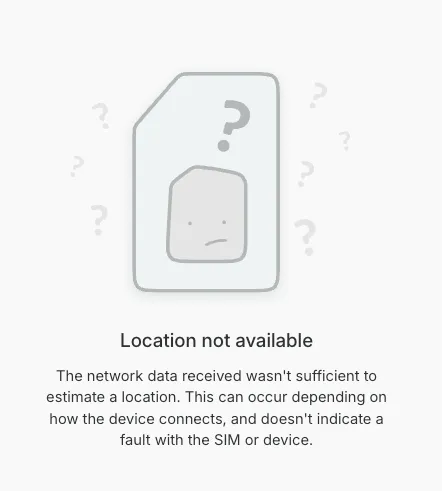
If the available network information is insufficient to estimate a location, "Location not available" will be displayed instead of the map. This does not indicate that the product itself has failed - location availability depends on the quality and availability of data from the cellular network, which is not always available or possible to interpret.
Using Location Services via API
Coming soon
Device Location Services API provides the data used by the Locations dashboard. It supports summary, country, product type and individual product location use cases.
- API access is subject to account permissions and authorisation.
- Location results are last-known approximate cellular locations.
For endpoint details, authentication and request examples, refer to the IoT.live API documentation.